A land of water
Thank you, Monsieur Riquet
Pierre-Paul Riquet realised that the only way to supply water to his future canal at its highest point on the plain of the Lauragais was to capture the generous rainfall of the Montagne Noire. He built two supply channels to take this water to the canal: the Rigole de la Montagne and the Rigole de la Plaine. The former terminates at Les Cammazes…
The Rigole de la Montagne
From the start of its journey at the Prise d’Alzeau, the Rigole de la Montagne follows its man-made path through the forest to the farm of Le Conquet. A few years after Riquet’s death, Louis XIV’s military engineer Vauban extended the rigole as far as Les Cammazes. In the middle of the village, he was obliged to tunnel 123 metres through solid rock so that the rigole could join the river Laudot and flow down the mountain to the reservoir at Saint-Ferréol.
A land to explore
On foot, bicycle or moutain bike
This countryside is made for those who like to travel under their own steam, be it on two feet or two wheels. Discover nature in all its tranquillity by following the rigole, or exploring the dam at Les Cammazes, the Forest of the Aiguille, the valley of the Sor, the GR7 long-distance footpath…whether you are a serious hiker or simply someone out for a stroll, you will find a path made for you.
As well as the GR7 which passes through the village, and the Rigole de la Montagne which runs all the way from the Prise d’Alzeau to Les Cammazes, you can follow lots of other pretty routes:
- The Forest of the Aiguille offers two waymarked routes – five or eight kilometres – and both will take you past the restored remains of kilns once used by charcoal burners.
- Vauban and the water courses of the mountain is a 7.5-kilometre circuit which will allow you to appreciate the peace and quiet of the rigole before returning to the village by a fishermen’s path near the shore of the reservoir.
- The Valley of the Sor is a 10.5-kilometre hike along some steep paths that will suit the more energetic. On the way you will pass the ruins of the Portal Mill and the remains of the Tower of Roquefort.
- The tour of the lake is a four-hour, 16.5-kilometre hike that sets off along the rocky contours of the steep hillside near the dam and then follows a path between the banks of the lake and the edge of the forest.
- The circuit of the crosses is a 5.5-kilometre stroll suitable for all the family in the immediate surroundings of the village. Along the way you will pass eleven crosses which were once the points where, on certain religious feast days, processions would stop to bless the inhabitants’ crops and livestock. The practice was ended in 1958.
Philippe Vauchelle
Passionate about Les Cammazes
Les Cammazes has a rich cultural heritage including the rigole, the Forest of the Aiguille and the dam on the Sor. But it is also an ideal place to enjoy all that nature can offer.
01
Time to escape
The fishermen's path
In this peaceful environment, you will almost believe you are on the shores of one of the great lakes of the High North.

02
Towards the source of the Canal du Midi
From Vauban to Riquet
Vauban’s tunnel in the centre of Les Cammazes is the starting point of a path alongside the rigole that will introduce you to the work of Riquet.
03
From the forest to the Sor Valley
A changing landscape
Pass through the forest and then drop down into the valley of the Sor to discover another world.
The forest of the Aiguille
This was once a vast royal forest that stretched as far as the gates of Revel and enveloped the road to Saissac. As with all the Montagne Noire, the Aiguille still contains vast reserves of trees.
Charcoal kilns
These were once used by the charcoal burners to transform wood from the surrounding forest into charcoal. Their internal combustion chambers allowed the kilns to adapt to different types of wood.
They were heavily used during the second world war to supply fuel for vehicles modified to run on wood gas. In 1958 they fell into disuse, but you will find three kilns in the Forest of the Aiguille that were restored in 2012.
Vauban and Riquet
If you follow the Rigole de la Montagne along its twenty-eight-kilometre route from Les Cammazes to the Prise d’Alzeau, you will only gain fifty metres in altitude! It’s an easy bicycle ride and most of the route is shaded by trees.
Alternatively, you could choose to wander along the same path as far as Lampy Lake where you can stop for a refreshing swim. But before setting off, be sure to walk through the darkness of Vauban’s tunnel which cuts through the rock for 123 metres and allows the rigole to traverse the village and discharge its waters into the Laudot.
1
The lake and the rigole
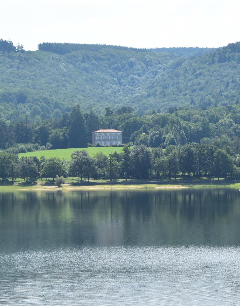
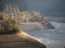
Discover the lake at Les Cammazes, otherwise known as the Gravette reservoir. It was built in the 1950s to guarantee a steady supply of drinking water to 170,000 people on the plain, and to supply an agricultural irrigation network. One-fifth of its water is reserved for the Canal du Midi.
You can make the circuit of its rugged 16.5-kilometre shoreline in around four hours, or you may prefer to branch off after a few kilometres and follow the itinerary for ‘Vauban and the waters of the Montagne Noire’ which follows the rigole. If you complete the tour of the lake, you will come back towards the dam along the fishermen’s path.
2
On foot or on horseback
There are many other routes to explore around the village: the Sor Valley is a little more energetic, the circuit of the crosses is more family-oriented, or for something different, a riding school called l’Etrier de la Montagne Noire offers spectacular horseback trips in the surrounding countryside.
And if you are more of a long-distance walker, you could always pick up the GR7 which passes through the village.
3
Situated on a road that passes among the lakes at the south-west extremity of the department of the Tarn, Les Cammazes occupies a plateau between the valleys of the Sor and Laudot in the midst of a vast forest.
At the gates of the Montagne Noire in the Regional Park of Haut-Languedoc, this village of 331 inhabitants is at an elevation of 615 metres and it enjoys a microclimate influenced by the Atlantic and the Mediterranean. It is also close to the neighbouring departments of the Aude and Haute-Garonne, and it is easy to reach the village from the roads linking Toulouse to Carcassonne or Albi.
Les Cammazes offers a rich choice of walks for visitors of all ages.
The great outdoors
This is a calm, restful and revitalising environment suitable for sport or relaxing. You can breathe in the air of the unspoilt countryside, and who knows, perhaps your visit will coincide with one of the many festive, sporting or cultural events which take place each year in the village. Come what may, you will always be welcome at Les Cammazes!