
The source of the Canal du Midi
An inovative system recognised by UNESCO
The Canal du Midi has a source? It certainly is not the Garonne or the Mediterranean. Neither does the water come from the rivers of the Lauragais or underground. No, it all starts in the Montagne Noire.
If you travel through the Montagne Noire, you can admire the genius of Pierre-Paul Riquet. He built two artificial water channels – the rigoles – to take water from the river Alzeau all the way down the mountain and across the plain to the canal’s highest point at the Seuil de Naurouze. This system was designated a UNESCO World Heritage site in 1996.
The beginning of the supply system
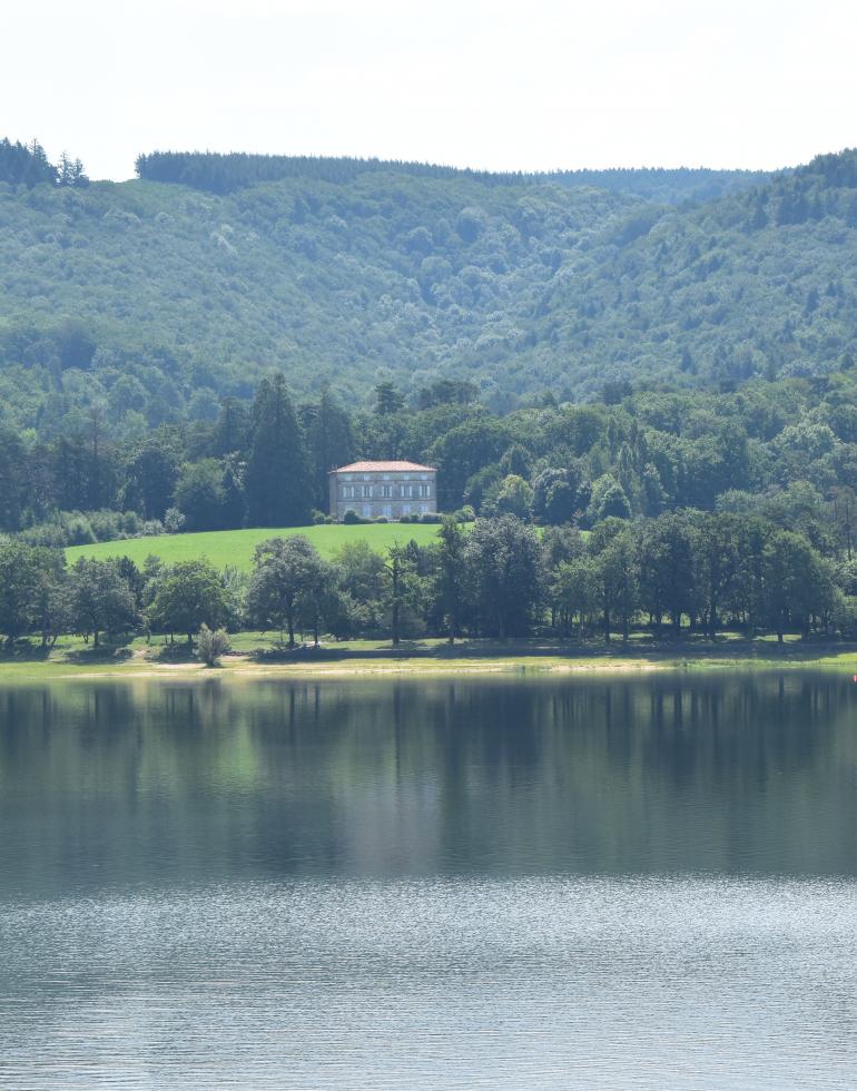
Go deep into the mountain to a place called the Prise d’Alzeau at an altitude of 684 metres. This is where Riquet diverted some of the water from the river into his first water channel known as the Rigole de la Montagne. This point on the Alzeau is the true source of the Canal du Midi, and nearby in the shade of the trees you will find a monument to the canal’s inventor.
How does it work?
The rigole de la Montagne and other feats of engineering
From the Prise d’Alzeau at 684 metres, the Rigole de la Montagne flows along its granite bed and gently crosses the contours of the mountain. You will appreciate the gradual nature of this descent if you walk or cycle along the service road which tracks the rigole throughout its course.
Three metres wide and up to a metre deep, the rigole gathers water from a dozen brooks and streams on its way to the farm of Le Conquet at 622 metres. Throughout this first section, trees grow across the water to create a shady tunnel which travellers will find refreshing.
Riquet’s rigole stops at the watershed of Le Conquet. From here, the water either joins the river Sor, or continues for seven kilometres along an extension added by Louis XIV’s military engineer, Sébastien Le Prestre de Vauban. At Les Cammazes, the rigole passes underneath the road in a tunnel – also built by Vauban. You too can pass through the tunnel if you like excitement.
After the tunnel, the rigole discharges its water into the river Laudot which flows down the mountain to join the lake at Saint-Ferréol, a romantic location offering water sports, fishing, hiking or relaxation. Don’t miss the fountain which sends water high into the air above the English landscape garden.
Florence et Jonathan
Two fans of the Canal du Midi
The Prise d’Alzeau is the ideal place for a relaxing walk among century-old trees. It also bears witness to the ingenuity of man, because it is the starting point of the Canal du Midi.
01
A water system from the past
Drinking water?
This system also supplies drinking water!
02
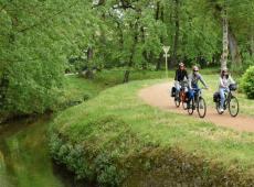
A prety outing for the young and the younger-at-heart
An activity for all the family
With its gentle gradient, a stroll alongside the rigole will suit the whole family.
03
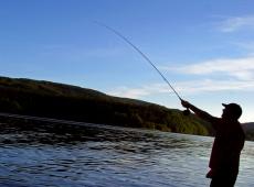
Water, fish and crayfish!
Do you like fishing?
Take advantage of the works of the Montagne Noire to combine your passion with history.
All the way to the Canal du Midi
Drawing its water from the river Sor, the Rigole de la Plaine flows around Revel to Les Thomassès where it joins up with the waters of the Laudot which have come down from Saint-Ferréol. The rigole runs all the way to the Seuil de Naurouze – a distance of thirty-eight kilometres.
From Les Thomassès to Naurouze
After Les Thomassès, small aqueducts enable the rigole to cross several streams and even the railway line. There is a track alongside it as far as the lake at Lenclas.
Mountain bikers and modern-day pilgrims on the GR 653 can follow the towpath all the way from Revel to the Seuil de Naurouze.
The prise d’Alzeau
Located at an altitude of 680 m, the Prise d’Alzeau is the start of the man-made water supply network created by Pierre-Paul Riquet. Here, some of the water from the Alzeau is diverted into an artificial channel called the Rigole de la Montagne.
Rigole de la Montagne
Three metres wide and up to a metre deep, the rigole flows for twenty-seven kilometres through the Montagne Noire. The service road which keeps it company provides a shady walking route for everyone.
In the height of summer, a stroll along its shady banks is a real delight!
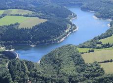
Lampy lake
Built in the 1780s, the reservoir at Lampy was built to meet the increased demand for water created by the building of the Canal du Jonction which connected the Canal du Midi to the Mediterranean via the Canal de la Robine. Today, Lampy is a beautiful lake surrounded by forests.
It is a romantic place perfect for swimming and fishing, or for a hike along the path around the lake or even on the GR7 long-distance footpath...
La Voûte Vauban (Vauban's tunnel)
This tunnel carries the rigole underground for 122 metres, and it also provides considerable amusement for children who will ask to go through it again and again. Thanks to the tunnel, the Rigole de la Montagne reaches its goal of joining up with the river Laudot.
The dam at Les Cammazes
This huge reservoir holds twenty million cubic metres of water and has a circumference of fifteen kilometres. It was built to supply water for drinking and irrigation. Some of the water from Riquet’s system flows through it.
The wall of the arch dam is seventy metres high, taller than the first level of the Eiffel Tower! Many will take pleasure in its well-stocked waters.
The rigole de la Plaine
A key part of Riquet’s supply system, the Rigole de la Plaine transports water from the Sor and Saint-Ferréol all the way to the Canal du Midi.